🌐 Quick Answer — What Is Mawsynram?
- Mawsynram is a village in the East Khasi Hills district of Meghalaya, northeast India.
- It holds the Guinness World Record for the world's highest average annual rainfall: approximately 11,871 mm per year.
- Located at 1,400 metres elevation, approximately 65 km from Shillong and 15 km from Cherrapunji (Sohra).
- Known for its stalactite cave, panoramic viewpoints over the Bangladesh plains, extraordinary monsoon landscape, and Khasi village culture.
- Best visited October–April; monsoon season (June–September) is extreme but extraordinary for adventurous travelers.
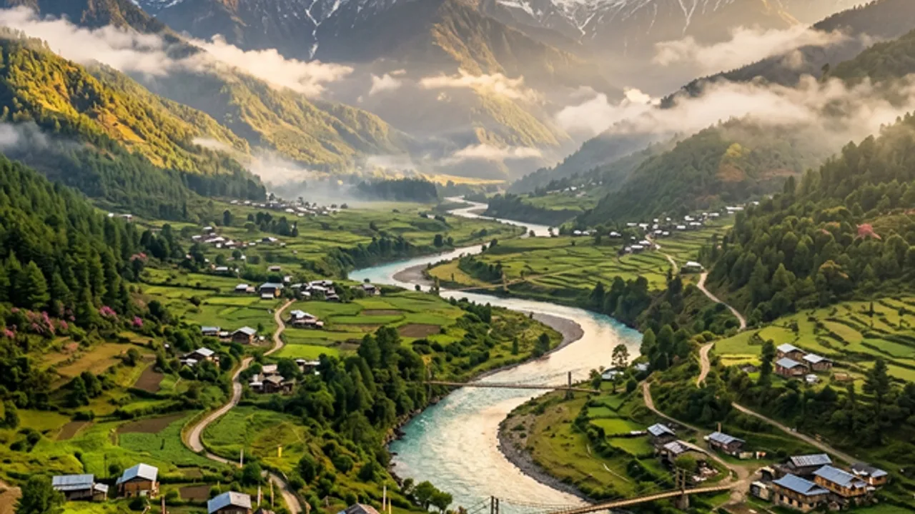
Most world records are celebrated. Mawsynram's is survived. Tucked into the southern escarpment of the Khasi Hills in Meghalaya at 1,400 metres, this village receives an average of 11,871 millimetres of rain every year — roughly 467 inches, a figure so extreme that it exceeds the annual rainfall of most tropical rainforests by a factor of three. The rain comes with a physical presence that visitors do not forget: the sound alone, a continuous roar that fills every hollow in the landscape, is unlike anything you will hear anywhere else on earth. And yet Mawsynram — the word itself means "abode of Maw" in Khasi, referring to a sacred stone — is also unexpectedly, profoundly beautiful. The moss here has had centuries to perfect its covering of every surface. The mist moves through the valley in slow, deliberate columns. The silence between storms is total and extraordinary.
"The rain in Mawsynram is not weather. It is geography. It is the sound of the landscape explaining itself."— Local Khasi saying, as told to TravelBuddiz by Bah Donbok, community guide, Mawsynram village

Why Mawsynram Is Unlike Any Destination in India
India has countless places of natural beauty. It has very few where the natural phenomenon itself — not a monument or a landscape feature but an atmospheric condition — is the destination. Mawsynram is one of them. The extreme rainfall that shaped this village also created its extraordinary ecology: a world of living moss-covered everything, waterfalls that appear to spring from the mist rather than from the ground, and valleys so deep and so green that they function like natural amphitheatres for the rain.
The Guinness World Records officially recognizes Mawsynram as the world's wettest inhabited place, with records going back to its measurement history beginning in the 1940s. The scientific reason is precise: moisture-laden southwest monsoon winds travel across the Bay of Bengal and the Bangladeshi plains, reaching the Khasi Hills escarpment and rising rapidly — the condensation is near-instant and total. The village sits directly in the path of this orographic lift.
World Record Rainfall
11,871 mm average annual rainfall — officially the highest of any inhabited place on earth, per Guinness World Records.
Living Moss Ecosystem
Centuries of extreme rainfall have produced an extraordinary moss and fern ecosystem where almost every surface is covered in living green.
Mawsynram Cave
A stalactite cave with a formation locally considered sacred — one of Meghalaya's most significant natural and spiritual sites.
Bangladesh Plains View
From viewpoints near the village, the Meghalaya escarpment drops suddenly to reveal the entire Bangladesh plains stretching to the horizon.
Khasi Culture
Mawsynram is a living Khasi community — matrilineal, deeply rooted in its forest and rain landscape, and extraordinarily welcoming to respectful visitors.
Genuine Offbeat
Most visitors to Meghalaya stop at Shillong and Cherrapunji. Mawsynram sees a fraction of those numbers — solitude is available even in peak season.
Best Time to Visit Mawsynram: Season by Season
The question of when to visit Mawsynram is not as simple as "dry season good, wet season bad." The monsoon here is genuinely extraordinary — a once-in-a-lifetime atmospheric experience. The honest answer is that the right time depends entirely on what you are coming for.
| Season | Months | Rainfall | Temperature | Best For | Verdict |
|---|---|---|---|---|---|
| ✦ Post-Monsoon | Oct–Nov | Moderate, clearing | 14–22°C | Best photography, lush green, fewer visitors | ★★★★★ |
| ✦ Winter | Dec–Feb | Low | 8–18°C | Clearest views, cool air, cave access | ★★★★★ |
| Spring | Mar–Apr | Pre-monsoon showers | 16–24°C | Wildflowers, good light, accessible roads | ★★★★ |
| 🌧 Peak Monsoon | Jun–Sep | Extreme — up to 1,500 mm/month | 18–25°C | Experiencing the record rainfall — adventurous only | ★★★ (specialist) |
| Late Monsoon | May | Monsoon beginning | 18–26°C | Early season green, possible landslides on roads | ★★★ |
How to Reach Mawsynram from Shillong, Guwahati & Beyond
From Shillong (Most Common Route)
Mawsynram is approximately 65 km southwest of Shillong and takes 2–3 hours by road via the Mawkyrwat route through the East Khasi Hills. Hire a local taxi or SUV from Shillong for the full journey — private vehicles are far more practical than the infrequent shared transport, and a local driver doubles as a guide for the mountain sections. The road winds through village after village of corrugated-iron-roofed Khasi houses, through forest that becomes progressively denser as you descend the escarpment. Budget ₹2,000–₹3,000 for a day trip taxi from Shillong; ₹3,500–₹4,500 for a driver-guide who will wait while you explore.
From Guwahati
Lokpriya Gopinath Bordoloi International Airport in Guwahati is the nearest major airport, served by direct flights from Delhi, Mumbai, Bangalore, Kolkata, and Chennai. From Guwahati, the drive to Shillong takes approximately 4 hours; add another 2–3 hours to Mawsynram. Plan for a minimum 2-night trip: overnight in Shillong, full day in Mawsynram and Cherrapunji, return.
Top Places to Visit in and Around Mawsynram
Mawsynram Cave (Krem Mawsynram)
The Stalactite That Named the VillageThe cave at the heart of Mawsynram contains a stalactite formation of extraordinary scale — a natural limestone column that over centuries of mineral deposition has grown into a shape revered by the Khasi community as a representation of a sacred stone (Maw). It is from this formation that the village takes its name: Maw-Syn-Ram, meaning roughly "abode of the golden stone."
The cave is cool, dim, and requires a guide from the village — a young local who will explain the spiritual significance of the formations and lead you through the sections accessible to visitors with a torch. The cave itself is a moderate walk from the main road through the village. The experience is as much about the community's relationship to this natural feature as about the geology itself.

Mawsynram Valley Viewpoints
Where the Khasi Hills Fall to the Plains of BangladeshThe southern edge of the Khasi Hills escarpment near Mawsynram drops with startling abruptness from the plateau at 1,400 metres to the Bangladeshi plains visible 60–80 km away. On a clear morning — November and December are the best months — the plains appear below as an infinite flat green expanse, often still in cloud while you stand above it in sunlight. The optical effect of watching clouds form below your feet is disorienting and extraordinary.
Multiple viewpoints are accessible from the village on foot or by vehicle. A local guide will take you to the ones that offer the best angle depending on time of day and season. The sunrise view, when the plains are still in darkness and the first light strikes the escarpment face below you, is among the finest natural spectacles in northeast India.

Nohkalikai Falls & Living Root Bridges (Cherrapunji)
India's Tallest Plunge Waterfall, 15 km from MawsynramCherrapunji (Sohra) is 15 kilometres from Mawsynram — virtually next door in mountain terms. Nohkalikai Falls drops 340 metres in a single plunge into a pool of extraordinary turquoise-green, surrounded by vertical cliff walls. It is India's tallest plunge waterfall and, during the monsoon, one of the most powerful natural spectacles on the subcontinent. In the post-monsoon months, the flow is still extraordinary and the pool colour is at its most vivid.
The Double Decker Living Root Bridge at Nongriat — a 3,500-step descent from the Tyrna village road — is the most photographed natural structure in Meghalaya. Two bridges stacked vertically, grown from the aerial roots of rubber fig trees over centuries of Khasi cultivation. The return climb takes 3–4 hours total and is physically demanding but entirely worth it. Start by 7 AM. Arrange through a TravelBuddiz local host for the best-timed experience.
Mawkdok Valley Viewpoint
The Gorge That Appears Without WarningOn the Shillong–Mawsynram road, approximately 25 km from Shillong, the road passes the edge of Mawkdok Valley — a sudden, deep gorge that the landscape offers without warning. The viewpoint here is one of the finest on the entire road: a forest-covered valley dropping several hundred metres, with the Kynmaw river visible as a thin silver thread at the bottom. In October and November, clouds sit below the viewpoint rim, obscuring the valley floor and revealing only the tree canopy above.
Stop here every time you pass. It is never the same twice. A zipline is available for those who want to cross the gorge at speed — one of Meghalaya's more unexpected adventure activities.
The living root bridges of the Khasi Hills — grown across generations, not built in an afternoon
Mawsynram vs Cherrapunji: Which Should You Visit?
This question comes up in every Meghalaya itinerary, and the answer is almost always: both. They are 15 km apart and genuinely complementary. But if you are forced to choose, here is the honest comparison.
| Factor | Mawsynram | Cherrapunji (Sohra) |
|---|---|---|
| World Record | ✦ Guinness Record holder (current) | Former record holder — now second |
| Tourism Infrastructure | Minimal — village experience | ✦ Better — more guesthouses, food options |
| Living Root Bridges | Not directly accessible | ✦ Nongriat Double Decker Bridge is here |
| Authentic Village Feel | ✦ Highly authentic — few tourists | More developed, more visited |
| Stalactite Cave | ✦ Krem Mawsynram cave (significant) | Mawsmai Cave (more accessible) |
| Valley Viewpoints | ✦ Less-visited, more dramatic drop | Nohsngithiang & Seven Sisters Falls views |
| Our Recommendation | ✦ Stay here for village immersion | ✦ Day trip for root bridges and Nohkalikai |
The ideal Meghalaya itinerary: arrive in Shillong, drive to Mawsynram, stay one or two nights in a village homestay, do the valley viewpoints and cave, then drive 15 km to Cherrapunji for the Nongriat root bridge trek and Nohkalikai Falls — returning through Shillong. Four days covers both properly.
Food & Accommodation in Mawsynram
Mawsynram is a village, not a tourist hub. Accommodation is homestay-based, food is whatever the family is cooking, and the experience is deeply local as a result. This is not a compromise — it is the reason to come here rather than staying in Cherrapunji's more developed guesthouses.
What to Eat
Khasi food is rice-forward, pork-heavy, and distinctively smoky — much of it cooked over wood fires in kitchens filled with the smell of dried meat and fermented ingredients. The cuisine is little-known outside northeast India and genuinely worth experiencing.
What to Pack for Mawsynram
🎒 Essential Packing List for the World's Wettest Place
Travel Tips for Mawsynram 2026
🌿 Insider Tips from TravelBuddiz Meghalaya Hosts
Hire a guide from the village itself, not from Shillong. The village-based guides — most of them young Khasi men who grew up walking these paths in every condition — know where the viewpoints open, which cave section to visit first for the best light, and how to read the weather window between rain bands. They also speak Khasi with the families, giving you access to conversations that are simply unavailable to travelers with Shillong-based city guides.
The best light at the viewpoints is 5:30–7:30 AM. Before the mist burns off and before the clouds build again for the midday rain. This means staying overnight in the village — one night makes the trip exponentially better than a day trip. A 5 AM wake-up in a Khasi homestay, with black tea and a clear view of the valley floor in pre-dawn darkness, is not an inconvenience. It is the point.
BSNL has the best coverage in this area. Jio and Airtel are patchy in deep valley sections. Download offline maps (Google Maps or Maps.me) for the full route before leaving Shillong. Save accommodation contact numbers, your guide's number, and emergency contacts offline. Do not rely on data connectivity for any critical navigation in the valley sections.
Respect the rain. Don't race through it. Travelers who try to see Mawsynram quickly — arrive at 10 AM, see the cave, photograph the view, leave by 2 PM — miss what the place actually is. The atmosphere requires time to settle into. Sit with the rain. Walk back to the guesthouse in it. Drink tea during it. The record rainfall is the experience. Let it be.
Combine with Nongriat root bridge for the perfect 3-day Meghalaya circuit. Day 1: Shillong → Mawkdok viewpoint → Mawsynram (overnight). Day 2: Dawn viewpoint → cave → drive 15 km to Cherrapunji, evening at Nohkalikai Falls overlook. Day 3: 7 AM descent to Nongriat living root bridge → return to Shillong. This covers both record-holder and the most photogenic single structure in northeast India in three days.
Frequently Asked Questions About Mawsynram
Mawsynram Does Not Ask You to Be Comfortable. It Asks You to Be Present.
There is a particular kind of traveler that Mawsynram suits — the one who is not running from the rain but toward it. Who finds the world's most extreme weather not threatening but fascinating. Who prefers a Khasi homestay kitchen to a hotel lobby. TravelBuddiz connects you with the local hosts who know this landscape in all its moods — and can show you the parts of it that no itinerary template reaches.
Find Meghalaya Trips with Local Hosts → Meet Verified Meghalaya Hosts